
Product
SEPM X-Raster
Import / Export — Made Simple
Raster import and export for Smallworld GIS. Import multiple raster files into Smallworld in one step, or export map data as raster tiles in standard file formats — with full control from the X-Raster user interface or as a Magik engine.
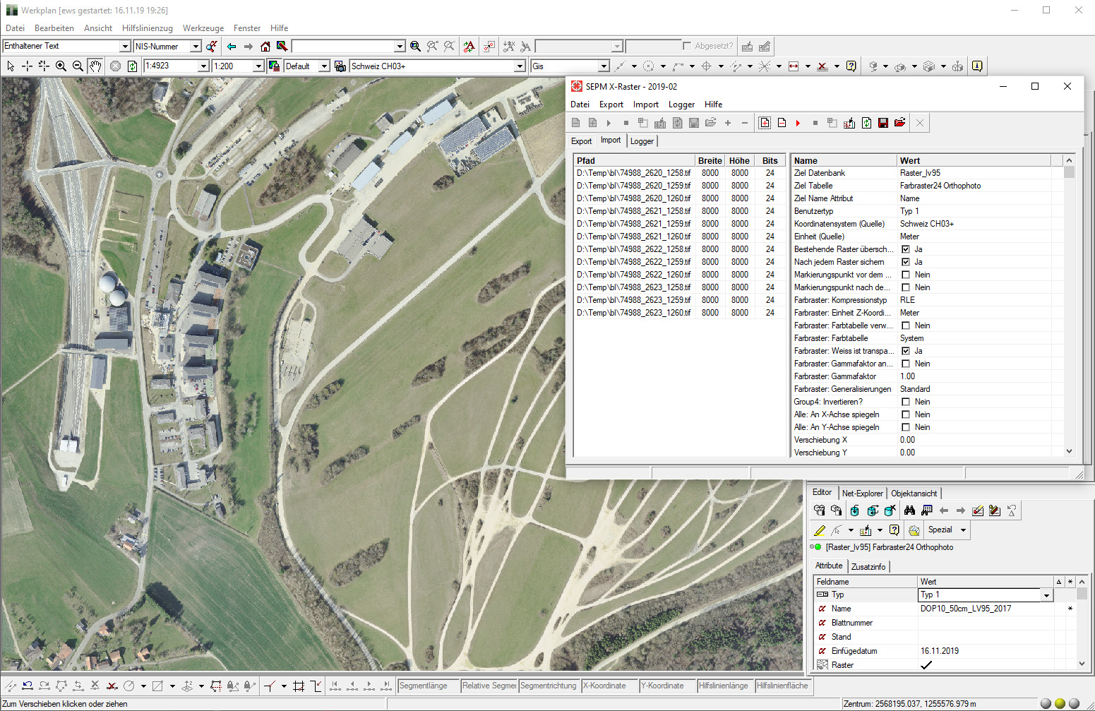
- Import formats
- BMP · TIFF · PNG
- Export formats
- JPEG · PNG · ECW · TIFF
- Smallworld versions
- Smallworld 4: 4.0/4.1/4.2/4.3 · Smallworld 5: 5.1/5.2/5.3
- Deployment
- SWAF GUI · Magik engines
Specifications
Raster import / export for Smallworld
With SEPM X-Raster, multiple raster files can be imported together into Smallworld in one step. The export function allows the export of Smallworld data as raster tiles in different file formats. Current SEPM releases also support Smallworld 6.x environments.
Import formats
- BMP
- TIFF
- PNG
Import functions
- Adjustable parameters
- Additional parameters
- Registration information
- GeoTIFF
- Preview feature
- Update feature
Export formats
- JPEG
- PNG
- ECW
- TIFF
Export functions
- Adjustable parameters
- Adjustable margins
- Aggregation of tiles
- Registration information
- Project information
- Can be used as an engine
Raster import
Selection of raster files, target collection and target geometry
Raster import starts with your file selection, a target collection and target geometry. X-Raster applies Smallworld raster import parameters, optional transforms and georeferencing, then loads the imagery into your GIS.
- 01
Select raster files
Choose BMP, TIFF or PNG sources — individually or as a batch — and point them at the Smallworld collection and geometry that should receive the data.
- 02
SEPM X-Raster
Sets underlying Smallworld raster import parameters, parses world files or GeoTIFF georeferencing, and optionally previews outlines and file names before load.
- 03
Target datastore
Georeferenced raster objects land in your Smallworld datastore. Existing objects can be updated with fresh raster data when files are re-imported.
Import
The advantages raster import gives you
- 01
Adjustable parameters
All parameters of the underlying Smallworld raster import functions can be set from the X-Raster user interface.
- 02
Additional parameters
Translations in the x/y direction and mirror operations around the x- or y-axis can be configured in the UI.
- 03
Registration information
World files (TFW) are parsed to position the raster data in the correct map location.
- 04
GeoTIFF
Georeferencing information can be extracted from GeoTIFF files when it represents an affine transformation.
- 05
Preview feature
Outlines and file names are displayed as previews before the import is committed.
- 06
Update feature
Existing raster objects can be updated with fresh raster data without rebuilding the workflow from scratch.
Raster export applications
Why teams export from Smallworld
Raster export delivers map data to recipients who do not receive vector data, archives data as-of a specific date, stores scanned plans as georeferenced raster files after GIS processing, and powers individual information solutions built on Smallworld.
Smallworld data
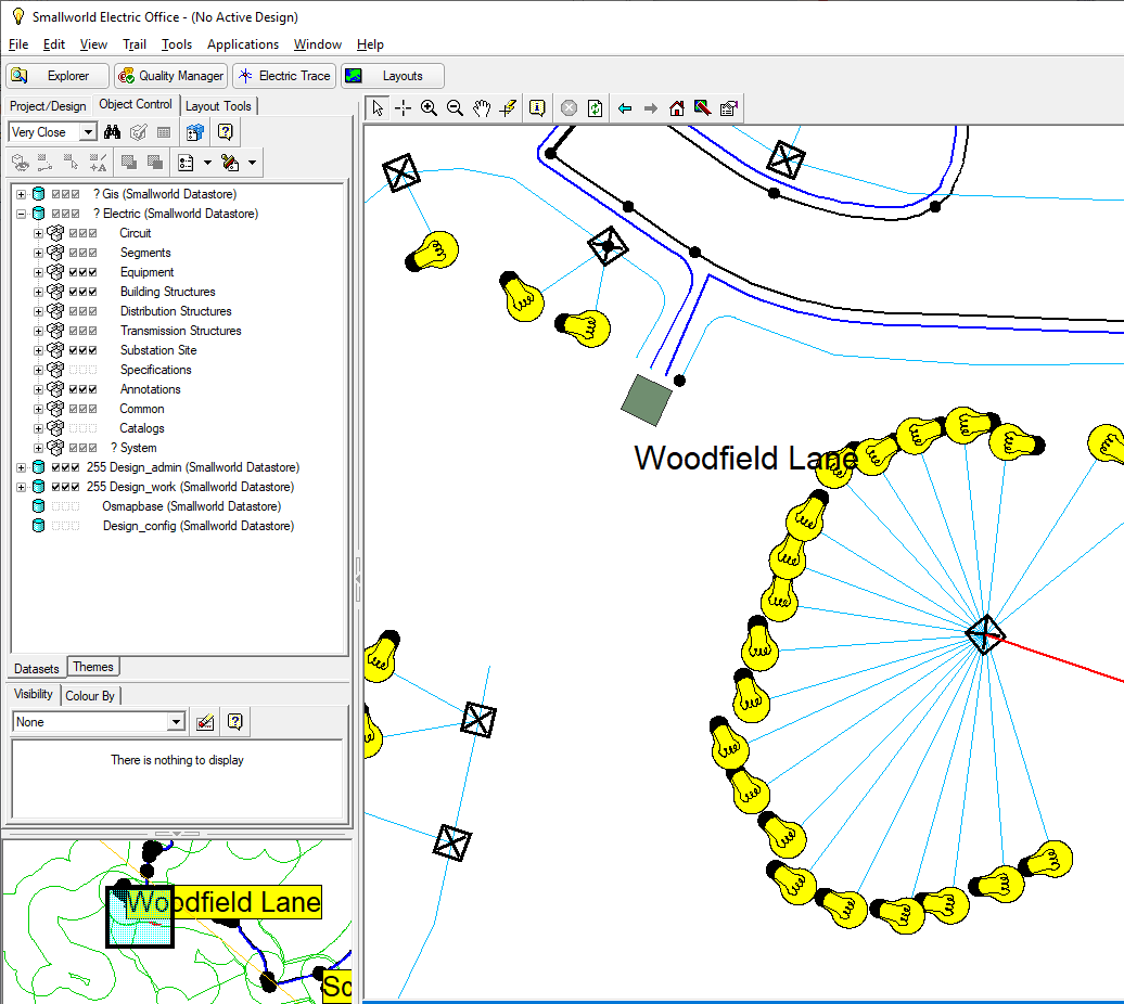
Exported raster section
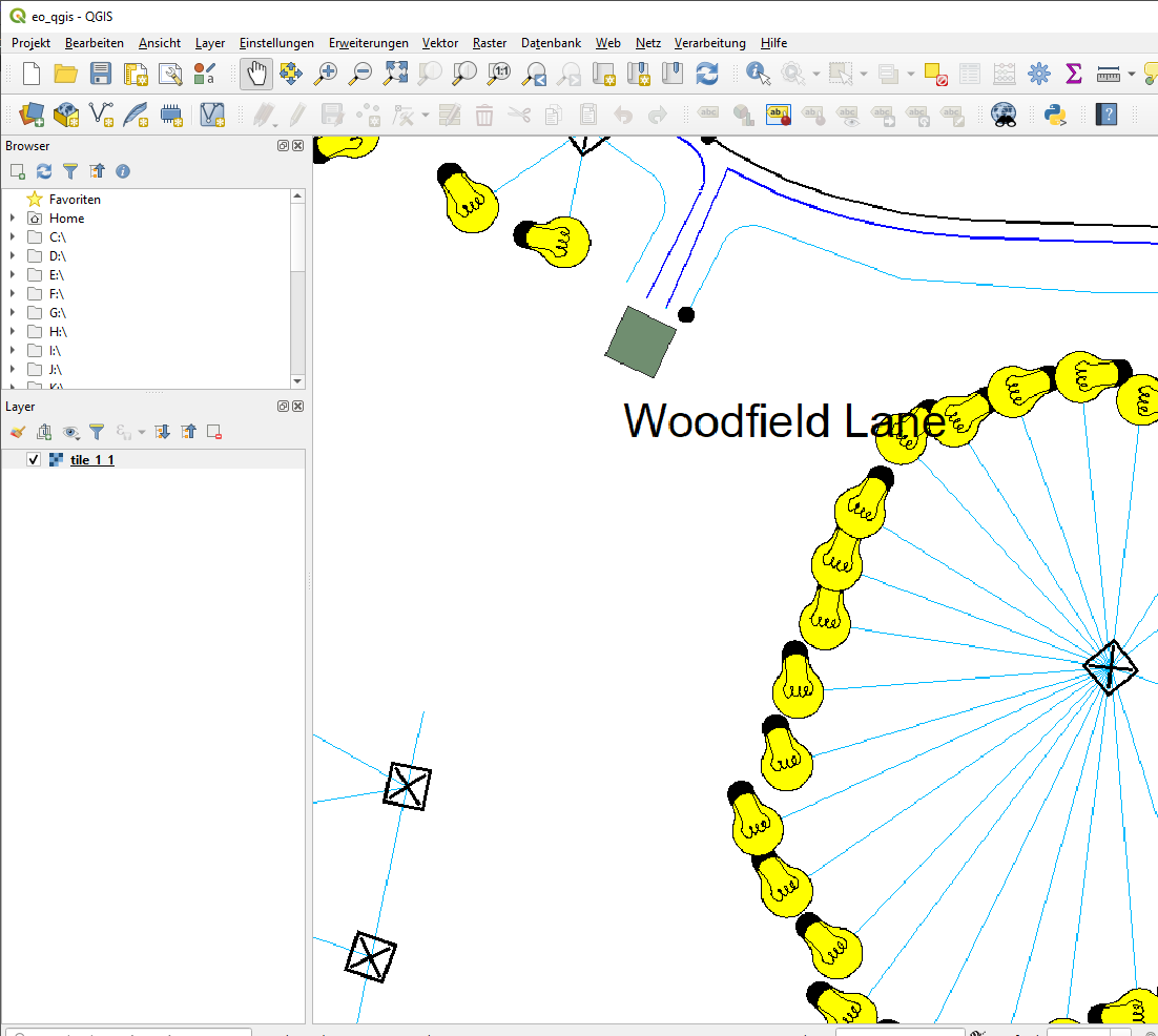
Raster-only delivery
Share map content as imagery when partners or regulators cannot accept vector deliverables.
Point-in-time archive
Freeze the visible map state on a given date as raster tiles for compliance or historical reference.
Scanned plan storage
Keep processed paper plans as georeferenced raster files inside your GIS landscape.
Custom solutions
Embed X-Raster as an engine in bespoke export or download workflows — for example TIFF download from a web application.
Export
The advantages raster export gives you
- 01
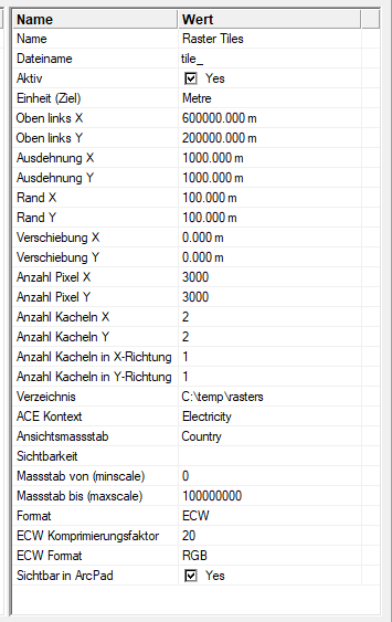
Adjustable parameters
Tile size and pixel size in the x- and y-directions are adjustable to match the target scale and file size.
- 02
Adjustable margin
Extend the rendered area beyond the tile edge so labels and symbols are not clipped at boundaries.
- 03
Aggregation of tiles
Adjacent tiles can be combined into larger raster files for simpler handoff or fewer files on disk.
- 04
Registration information
A TFW world file is created automatically so imagery can be positioned geographically in the target system.
- 05
Project information
ArcPad and ArcExplorer project files can be generated when field teams need ready-made mobile projects.
- 06
Use it as an engine
Run headless export through Magik for automated jobs — for example a “download to TIFF” feature in a web application.
Related case studies

Data Migration
Moving data to GISMobil — all vector, attribute and raster data migrated
Read the full case study
Planning raster import or export in Smallworld?
Talk to SEPM